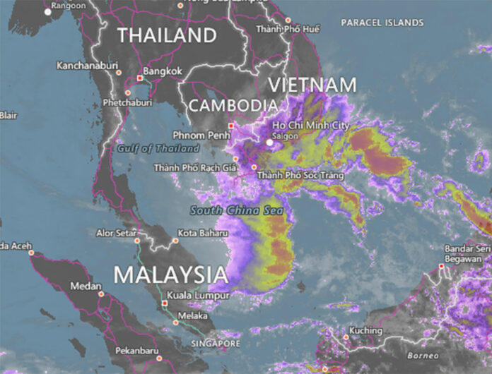
BANGKOK — Disaster officials were holding emergency meetings Wednesday to prepare for a newly upgraded tropical storm that is bearing down on the south of Thailand.
The storm, now called Pabuk and moving west at 10kph from the South China Sea into the Gulf of Thailand with gusts of up to 65kph, is likely to be the most devastating one to hit the region since 1962, a meteorologist said today. It’s set to make landfall Thursday at the southern tip of Thailand and then careen all the way north, according to Seree Supratid of the Climate Change and Disaster Center at Rangsit University.
“It will sweep up the whole south beginning from Narathiwat and Pattani. On Friday, it will move up to Songkhla, Nakhon Si Thammarat and Surat Thani. Then on Saturday, it will go to Chumphon and [Prachuap Khiri Khan],” he said.
Update: Storm Pabuk to Hit Nakhon, Chumphon, Surat Hardest: Official
Although Pabuk is less powerful than Typhoon Gay, which devastated Chumphon and Prachuap in 1989, Seree said it could cause more damage than a tropical storm that ravaged 12 southern provinces in 1962.
“The direction is different. This one will sweep through wider areas,” he said. “The damage could be greater than Harriet. Rainfall is expected to be up to 200 millimeters per day.”
More than 900 people died when Harriet cut straight across Nakhon Si Thammarat through Krabi, Phuket and Phang Nga. It went out to the Andaman Sea the following day.
On Tuesday, the state petrochemical company PTT announced it had evacuated some staff from a drilling platform off the coast of Songkhla and suspended other offshore operations.
Related stories:


