


C.P. Group, through its Charoen Pokphand Produce Co., Ltd. (CPP) and Bangkok Produce PLC (BKP) subsidiaries, is partnering with the Myanmar Corn Industrial Association (MCIA) in the adoption of pioneering technology to improve the traceability of corn in Myanmar’s supply chain.
This trailblazing initiative leverages satellite imagery and blockchain technology to flag any corn produced in forested areas or by farms using slash-and-burn practices. This will hugely benefit efforts to protect the environment – particularly with tackling cross-border smog and haze pollution – and raise levels of trust in the domestic and international markets.
Mr. Worrasit Sitthivichai, Chief Operating Officer, CPP Myanmar, emphasized CPP’s readiness to collaborate with partners, traders, and farmers in implementing 100% traceability for both seeds and feed corn. The initiative aligns with the vision of CP Group’s leaders — Mr. Dhanin Chearavanont, Mr. Supakit Chearavanont, and Mr. Suphachai Chearavanont— who prioritize swift, decisive action to support sustainable development.
The programme is initially being rolled out across 570,000 acres in the southern part of Shan State , one of Myanmar’s largest corn-growing regions, where CPP and BKP are integrating the latest technology with a traceability system already operational in the area .
The system employs six critical steps to ensure the preservation of forested areas and support sustainable practices:
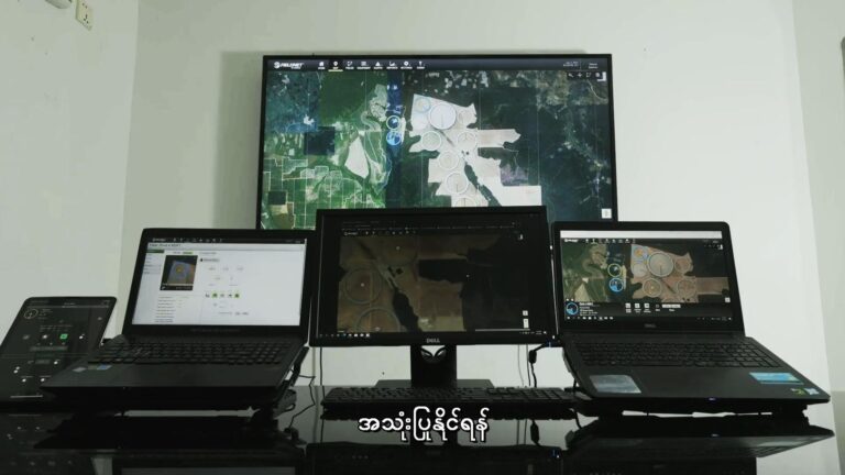
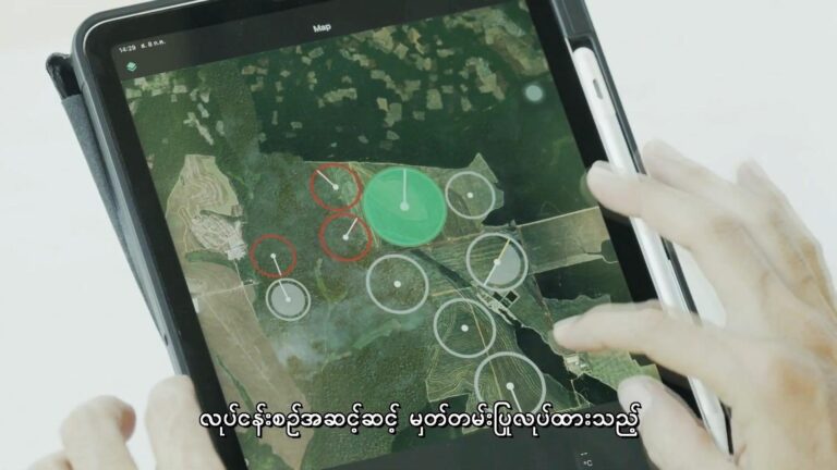
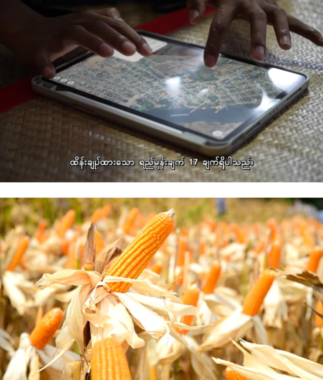
- Registration and Plot Mapping: All stakeholders, including farmers and corn traders, are registered. Detailed maps of each farming plot are created with precise coordinates.
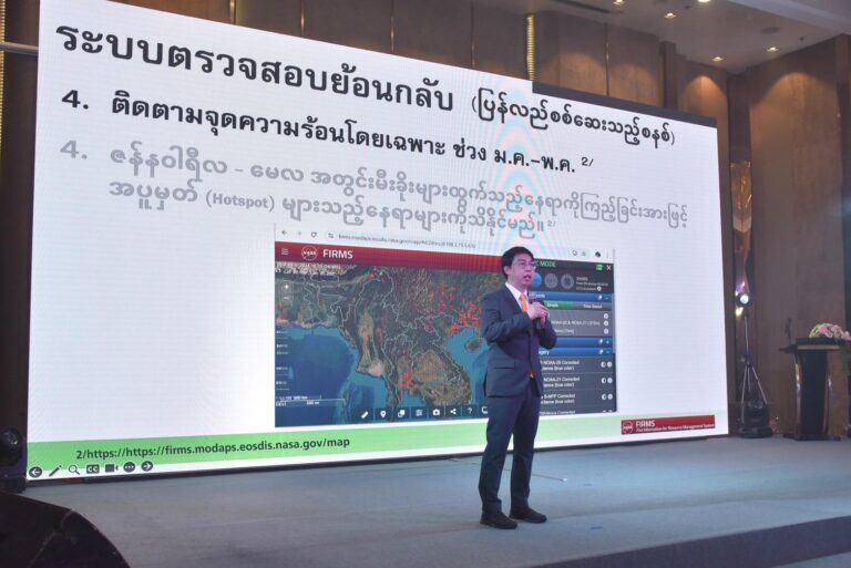
- Satellite Imagery for Plot Verification: Satellite technology validates and monitors cultivation areas to prevent forest encroachment and field burning.
- Forest Boundary Check: Historical data on forested areas since 2020 is reviewed to ensure compliance with EU Deforestation Regulation (EUDR). Non-cultivable forest areas are excluded.
- Hotspot Monitoring (Jan-May): The system tracks hotspots during peak fire-risk months, with one hotspot equating to 15.4 rai.
- 5. Burnt Area Calculation: Areas affected by burning are excluded from total cultivation land.
- Net Area Verification and Data Collection: After accounting for forest and burnt areas, the system calculates the net cultivable area, recording production data from cultivation to export for full transparency.
“This pilot in southern Shan State establishes a new standard for Myanmar’s corn industry,” said Mr. Worasit. “Traceability enhances buyer confidence, reduces [adverse] environmental impact, and promotes sustainability through innovative satellite and blockchain technologies.”
Mr. U Aung San Aung, Chairman of Myanmar corn industrial association (MCIA), lauded the traceability system as a game-changer for corn production in Myanmar, facilitating access to high-standard markets and ensuring a sustainable supply chain.
Dr. Pyo Ko Ko Naing, Managing Director of Alliance Eagles Group Limited and Secretary of Myanmar corn industrial association (MCIA), highlighted the environmental and cross-border haze mitigation benefits, pledging full support for the program while collaborating with farmers and traders to meet stringent environmental standards.
C.P. Group’s traceability initiative is indicative of industry-wide collaboration to address consumer demand for transparency and high standards while fostering economic, social, and environmental sustainability.
The southern part of Shan State is located in Myanmar’s highlands, bordering China, Laos, and Thailand. It spans 104.2 million rai, comprising of forested area (74.8%), grasslands (15.5%), and agricultural land (7.8%). Corn cultivation accounts for 22% of its farmland, second only to rice.


