


From Russian war games to lava flows on Hawaii to raging fires in California, images gathered from high above Earth by satellites in 2018 delivered a unique perspective on humanity, geopolitics, and the forces of nature that have upended lives and landscape.
Here’s a look at eight of the most striking news images captured by satellite imagery company DigitalGlobe — and photos made by Associated Press photographers who were on the ground:
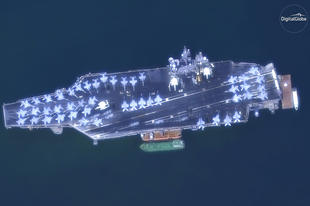
BACK TO DANANG
In a message to China, the American aircraft carrier USS Carl Vinson docked at Danang bay in Vietnam on March 5. In the first visit to a Vietnamese port by a US Navy aircraft carrier since the Vietnam War, the Vinson and its crew of more than 6,000 sent a signal from the two countries to China, which has stepped up its challenges to U.S. supremacy in the region. From space, the message was clear in the dozens of fighter jets on deck.
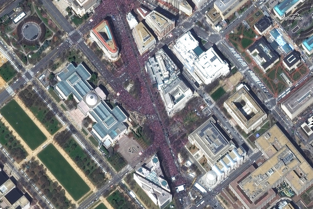
MARCH FOR OUR LIVES
When survivors of the school shooting in Parkland, Florida, called for action, hundreds of thousands marched in cities across America on March 24. The “March for Our Lives” rallies demonstrated a new level of activism for the majority of Americans who want stricter gun control laws. The satellites showed the scale of the activism in the biggest of the demonstrations at the nation’s capital.
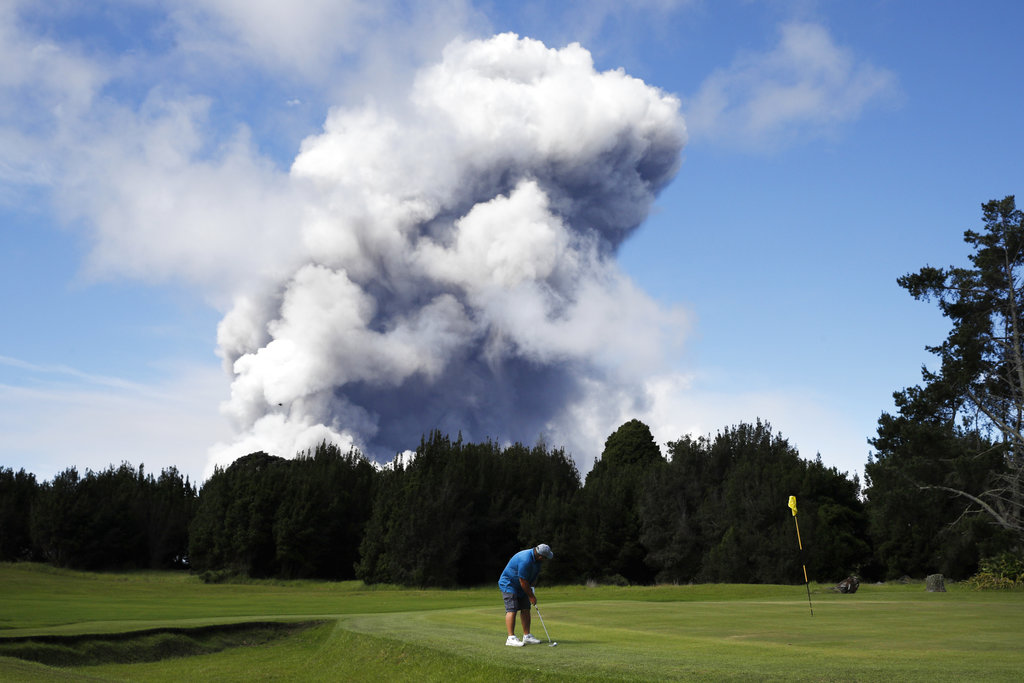
LAVA AND ASH
The eruption of Kilauea on the Big Island of Hawaii on May 3 wrecked more than 700 homes while captivating the world with its destructive force. Using infrared technology, a satellite captured the range of heat from a river of lava in vivid colors on May 13. At a safe distance from the eruption, life — even golf — went on in Hawaii.
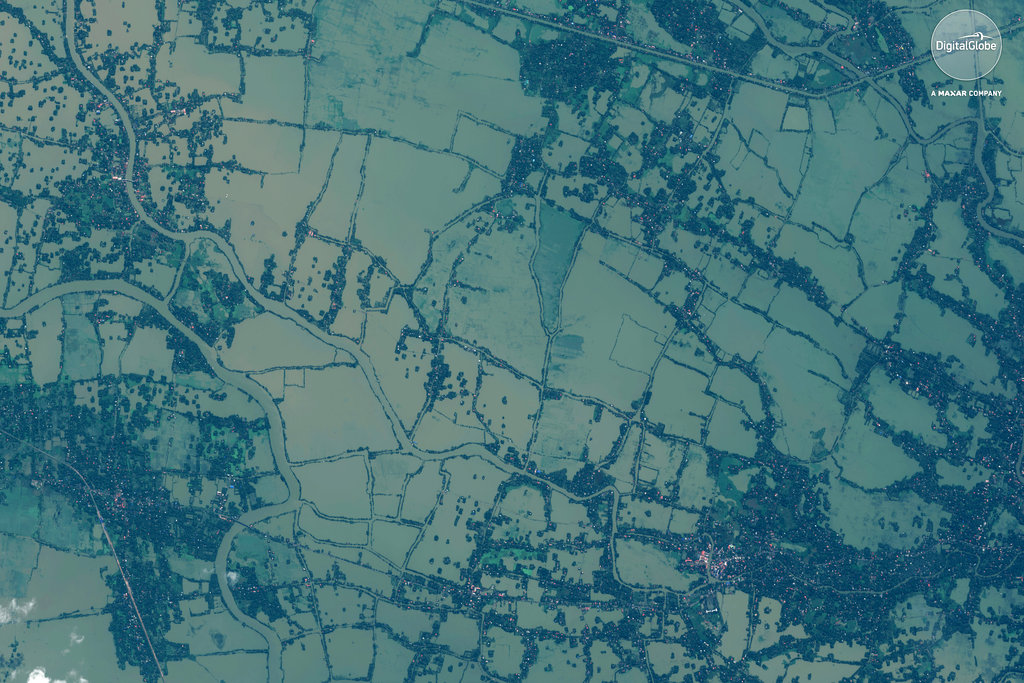
KERALA UNDER WATER
Storms in August battered the southern Indian state of Kerala. The flooding killed hundreds and left hundreds of thousands homeless. A satellite image on Aug. 22 revealed how the landscape had been turned into a temporary lake, while AP journalists on the ground captured the human toll, including a man in a canoe with his dog and rowing past a tree from which a bicycle hung above the flood waters.
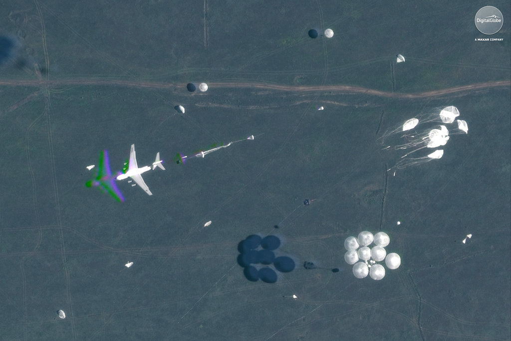
RUSSIAN SHOW OF MIGHT
In September, Russia put on its biggest show of force since the height of the Cold War. Russian officials said the military exercises in Siberia and the Far East, involved 300,000 Russian troops, 1,000 aircraft and 36,000 tanks. But for Western analysts the biggest message was the participation of Chinese troops in joint military exercises. Digital Globe satellites captured some of the drama as parachutes dropped military equipment on Sept. 15.
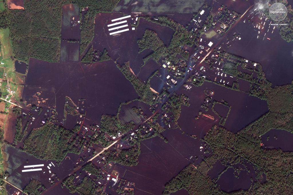
NORTH CAROLINA DROWNING
In mid-September, Hurricane Florence dumped over 30 inches (0.76 meters) of rain in parts of eastern North Carolina. More than a dozen people were killed in the storm and floods. The view from space reveals the inundation.
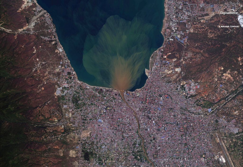
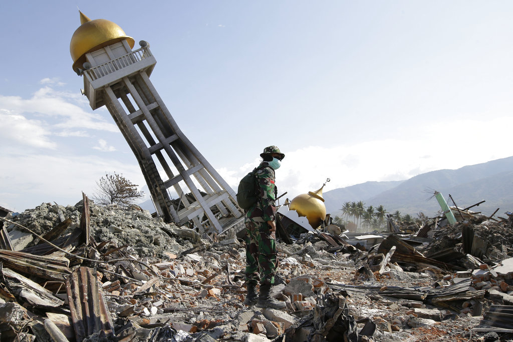
A CITY SWATH, LIQUIFIED
A massive earthquake wiped out whole neighborhoods of the Indonesian city of Palau on Sept. 28 when 430 hectares (1.7 square miles) of land were liquefied into deadly mudslides. It was clear from above how vast the destruction was and from the ground how complete.
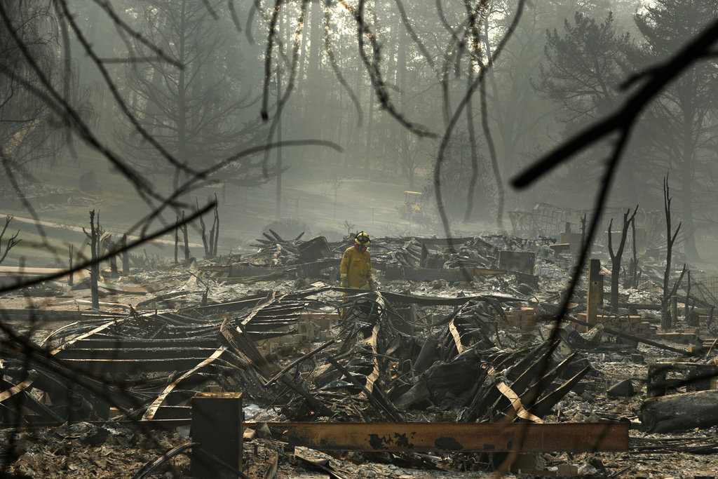
PARADISE IN FLAMES
The deadliest U.S. wildfire in a century sparked off in Northern California in November killing dozens and causing billions of dollars of damage. The satellites showed the complete destruction of the town of Paradise, CA, where 27,000 people had lived. An AP photo at ground-level showed the toll of the destruction.
Story: Desmond Butler


