


The rescue operation to bring back to the surface the 12 Wild Boars and their football coach in July was a story of divers, brave rescuers, self-sacrificing Navy SEALs and related experts.
Less known, the story was also one of cartographers. The painstaking task of creating accurate maps for divers to locate and retrieve those trapped inside Luang Cave relied on digitally compiling hand-drawn maps penned by past French and British explorers. Those maps proved a crucial, if little-known element in the successful rescue.
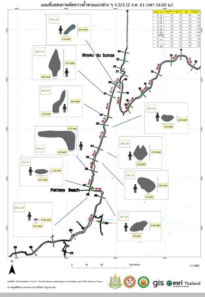
When news that the children were likely trapped in the cave located in Chiang Rai province broke June 23, there were no complete maps of the cave for immediate use. Thus, there was a need to make a composite map based on those that existed – an effort that involved Thai, French and English experts before it was completed and proved pivotal in the three-day evacuation two weeks later.
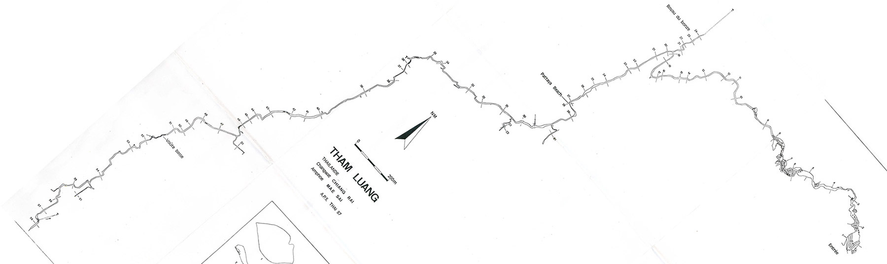
 The first map of Luang Cave was published in 1988 by the French Association Pyreneenne de Speleologie (Pyrenean Association of Speleology) one year after a mission touring caves in Southeast Asia passed through.
“There were speleologists and scientists, some of them very serious. They were six or seven camping in my home, in the living room, on the sofa,” said Louis Gabaude, a member of Ecole Francaise d’Extreme-Orient (French School of the Far-East), who accommodated the team at his Chiang Mai house. The team included Louis Deharveng, Anne Bedos, Didier Rigal and Daniel Dalger.
“For us, it was a hobby,” Deharveng said. “We were exploring caves because we liked it, but we had no financial support whatsoever, we were using our own money”.
Despite this lack of resources, the 1987 expedition was a milestone: The team surveyed most of the Luang Cave and drew a map with descriptions which were crucial for future cave surveyors. This first exploration was not without its excitement.
We were exploring caves because we liked it, but we had no financial support whatsoever
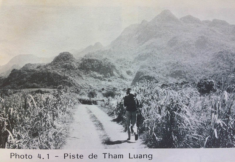
“We went into the cave with a village chief and an extraordinary Buddhist monk, inquisitive and athletic. He walked for about 4 kilometers inside the cave, barefoot and without helmet. When he exited the cave, he had several bleeding wounds,” Deharveng said.
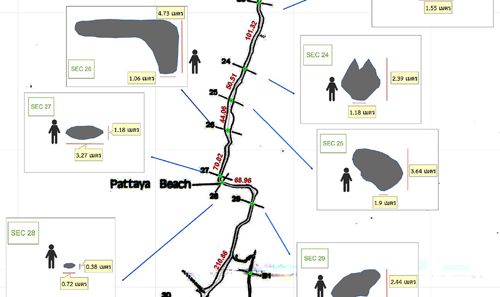
The main characteristics of the cave, about 8 kilometers long, were established: It was not labyrinthine, but rather a single path following a river course. The surveyors noted it “still runs during the dry season and rises during the rainy season,” the conditions which would create the boys’ predicament three decades later.
But the cave was not completely surveyed. English speleologists completed the job between 2012 and 2016. Several English missions to Luang Cave; which involved cave experts Vern Unsworth, Rob Harper, Phil Collet and Martin Ellis; made it possible to map the unfinished sections, including the cave’s entrance, under the name Sai Thong Cave.
“The British could cross sections which we were not able to cross. They added 200 or 300 meters of surveyed cave area in the south and about 200 meters in the north,” Deharveng said.
More specifically, Martin Ellis said the English missions allowed exploration and survey of “the Nang Non series (between the cave entrance and the Sam Yaek junction), the Monk’s series and the main caves extensions; [Sai Thong Cave] was also re-surveyed in this period.”
Navigating those locales inside the cave would prove critical for rescuers who had to not only traverse them to find those lost inside, but also be able to make the return trip with them in tow.
Martin Ellis, who has written several books on Thai caves and maintains a blog on the topic, was a key figure in making the final map used for the rescue. On June 26, three days after the footballers went missing, he was contacted by the Mineral Resources Department.
“They had found the cave surveys on my website,” he said via email.
Ellis supplied the department with scans of the original French survey, Rob Harper’s survey of the main cave extensions and his own composite survey, including of Sai Thong Cave, as well as digital models of the cave created from the surveys.
Ellis says he remains a bit skeptical about the accuracy of the 1987 French survey.
“The biggest problem is that there is no elevation data for the main part of the cave – it is two-dimensional,” he said.
On June 30, two days before the boys would be found alive inside, he wrote a warning on his blog.
“It must be stressed that the [Luang Cave] survey is very inaccurate and cannot be used, on its own, to select drilling targets.”
In any case, geographers with digital cartography firm GIS Co. Ltd. were willing to digitize the French and other maps for use by rescuers.
That created a need to translate the map and French notations into Thai, very technical work that had to be completed urgently. Napadol Wirakan, who holds a doctorate in French literature, was contacted and began work immediately.
“I translated the description of the cave; it was about two pages. Some words were very specific, and I could not understand with a usual dictionary. A friend provided me with a lexicon of speleology,” Napadol said. A team of Thai-French translators was set up next under the supervision of a Chulalongkorn University, as well as a team of translators for the English surveys.
The original and translated maps were given to the cartography company GIS Co Ltd, which compose a final map to be used in the rescue operation and which contributed to its success.
“This final map was very important. It helped a lot the rescuers and divers to make decisions,” said Napadol, who was granted – as well as his fellow translators – a certificate of thanks by the ministry of natural resources and environment. “At that time, I felt that it was like a moment of national union. Everyone was joining forces to save these children. It showed the unification of Thai people.”


